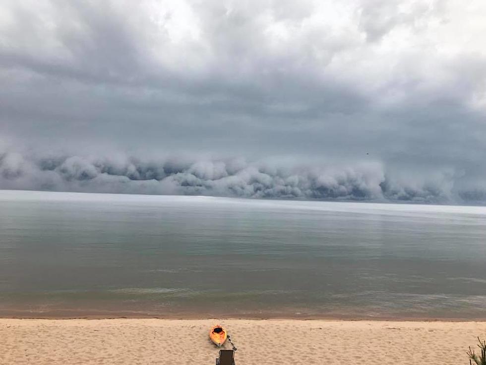
Rolling Cloud Approaches Beach from Lake Superior
Nature can and usually is a beautiful thing, whether it is dangerous or just looks dangerous. There was another example last Saturday when Holly Marenger in Au Train Township, Munising, MI saw and videoed “an awesome sight to watch”. She stated that she first saw the water pull back from the beach approximately 300 feet. She then said that within five minutes of that happening the water came back in and very strange looking clouds started to form on the horizon from the Lake Superior beach she was at. What she saw was the formation of a combination of a roll cloud and a fog bank. According to weatheronline a roll cloud is:
a relatively rare, low-level horizontal, tube-shaped accessory cloud completely detached from the cumulonimbus base, unlike the more common shelf cloud. When present, it is located along the gust front and most frequently observed on the leading edge of a line of thunderstorms, a cold front or line squalls. The roll cloud will appear to be slowly "rolling" about its horizontal axis. Roll clouds are not and do not produce tornadoes.
Whatever it is, it is certainly interesting and beautiful in its own ominous way. Check out her Facebook site to see an actually video she took of the cloud, the following video is from her Facebook page:
Fox News recently reported on and published a picture of a Rolling Cloud in Tennessee laws week, click on the Fox News hotlink to check it out.
More From WBCKFM


